Kuala Lumpur Maps and Orientation
(Kuala Lumpur, Federal Territory, Malaysia)
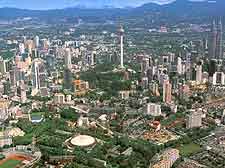
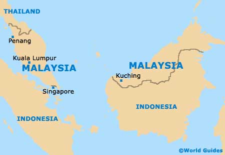
Malaysia's capital city, Kuala Lumpur is also the biggest city in the country and is home to almost two million residents. The city lies on the westerly side of
Malaysia and within the region known as Greater Kuala Lumpur (Klang Valley), which boasts a total population now exceeding seven million.
Finding your way around Kuala Lumpur is generally considered straightforward, although many visitors will find that traversing the city on foot can be a little difficult, with public transport often being favoured. If required, city maps can be found within the bookstores along the Jalan Ampang and the Jalan Yap Kwan Seng, or at the Tourism Malaysia office within the Putra World Trade Centre (PWTC).
Maps and Orientation of the City
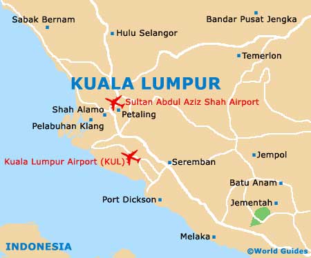
The historical centre of Kuala Lumpur lies around Merdeka Square, close to the riverfronts. If you head south-east of Merdeka Square, you will soon reach the vibrant oriental district of Chinatown, where cheap accommodation is most likely to be available. Located on the westerly side of Chinatown are a number of major highways, along with the Kuala Lumpur Train Station.
Another very important part of Kuala Lumpur is Puduraya, which is where you will find a popular long-distance bus terminal. To the east, both the Jalan Bukit Bintang and the Jalan Sultan Ismail form the centre of the Golden Triangle, where business and entertainment are successfully combined. South of the Golden Triangle, the Kuala Lumpur City Centre (KLCC) boasts the world-famous Petronas Twin Towers, amongst many other striking modern landmarks.
- Fraser's Hill - north
- Gemas - south-east
- Genting Highlands - north
- Georgetown - north-west
- Kelang - west
- Kota Baharu - north
- Kuala Dungun - north-east
- Kuala Selangor - north-west
- Kuala Terengganu - north-east
- Kuantan - east
- Lumut - north-west
- Melaka - south
- Penang - north-west
- Port Dickinson - south
- Port Klang - south-west
- Seremban - south
- Singapore City (Singapore) - south
- Sunway Lagoon - south-west
- Taiping - north-west
- Tasik Chini - east
- Teluk Intan - north-west
Map of Malaysia
Map of Kuala Lumpur